
Follow the river north from San Pedro and the oasis soon narrows between the bare walls of a valley. Then, on the left, a hillside comes into view covered in low stone walls, rising in tiers almost to the summit. This is the Pukará de Quitor, a fortress built by the Lickanantay people of the oasis around the twelfth century, and one of the most important archaeological sites in northern Chile.
A pukará is a fortified settlement on a hill, a common form in the Andes. This one guarded the northern entrance to the oasis and the route along the river towards the high plateau. Standing on its walls, you see at once why the builders chose it.
The fortress on the hill
The walls are made of local stone laid with mud, following the slope in a dense pattern of small rooms, passages and terraces. More than a hundred and sixty enclosures have been counted, many of them only a few metres across. Some were houses, some stores for food and water, and some may have been pens for llamas. In times of danger, the people of the surrounding farms could retreat inside.
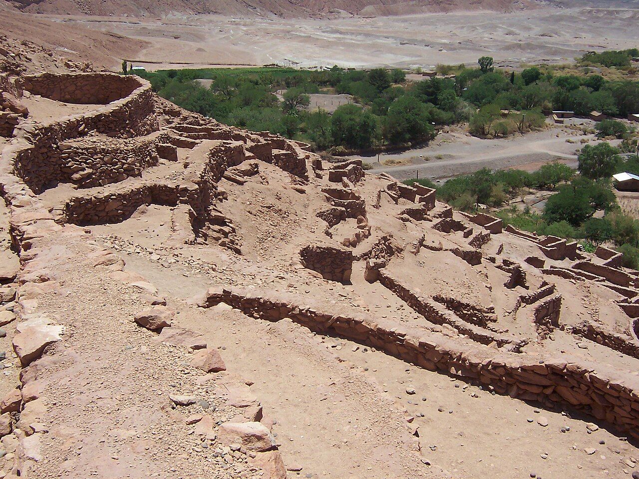
The position is strong. The hill rises steeply from the riverbank on one side, and the upper walls command a view of anyone approaching up or down the valley. Defenders could watch for movement long before it arrived. Even today, the steepness of the slope is the first thing your legs notice.
The site lies on the land of the Quitor community, one of the ayllus, or traditional family communities, that make up the oasis. The community manages visits and charges an entry fee, and it maintains the paths. Opening times are set locally, so ask in town before you walk out.
The Spanish arrival
In 1540 Spanish soldiers moving south towards central Chile reached the oasis. The people of the area resisted, and the Pukará de Quitor became the scene of a fierce fight. The Spanish took the fortress, and accounts from the period describe a harsh punishment of its defenders afterwards. It marked the beginning of colonial rule in the region, though the communities of the oasis kept their land, their language and many of their customs for a long time afterwards.
The site was declared a national monument in 1982, and parts of the walls have been carefully restored. It remains a place of memory for the communities whose ancestors built and defended it, and the history told here is their history rather than a distant curiosity.
Look up next: The Lickanantay people and the land
Walking the site
A path leads up through the ruins from the entrance by the river. It is steep in places, with uneven steps and loose gravel, and it climbs a little over a hundred metres to the upper part of the hill. Take it slowly, especially in your first days at this altitude. There is very little shade.
- Stay on the marked path. The walls are old and fragile, and stepping on them damages them.
- Do not move or stack stones, even loose ones.
- Keep children close on the steeper sections, where the drop beside the path is real.
- Carry water; there is nowhere to buy it on the hill.
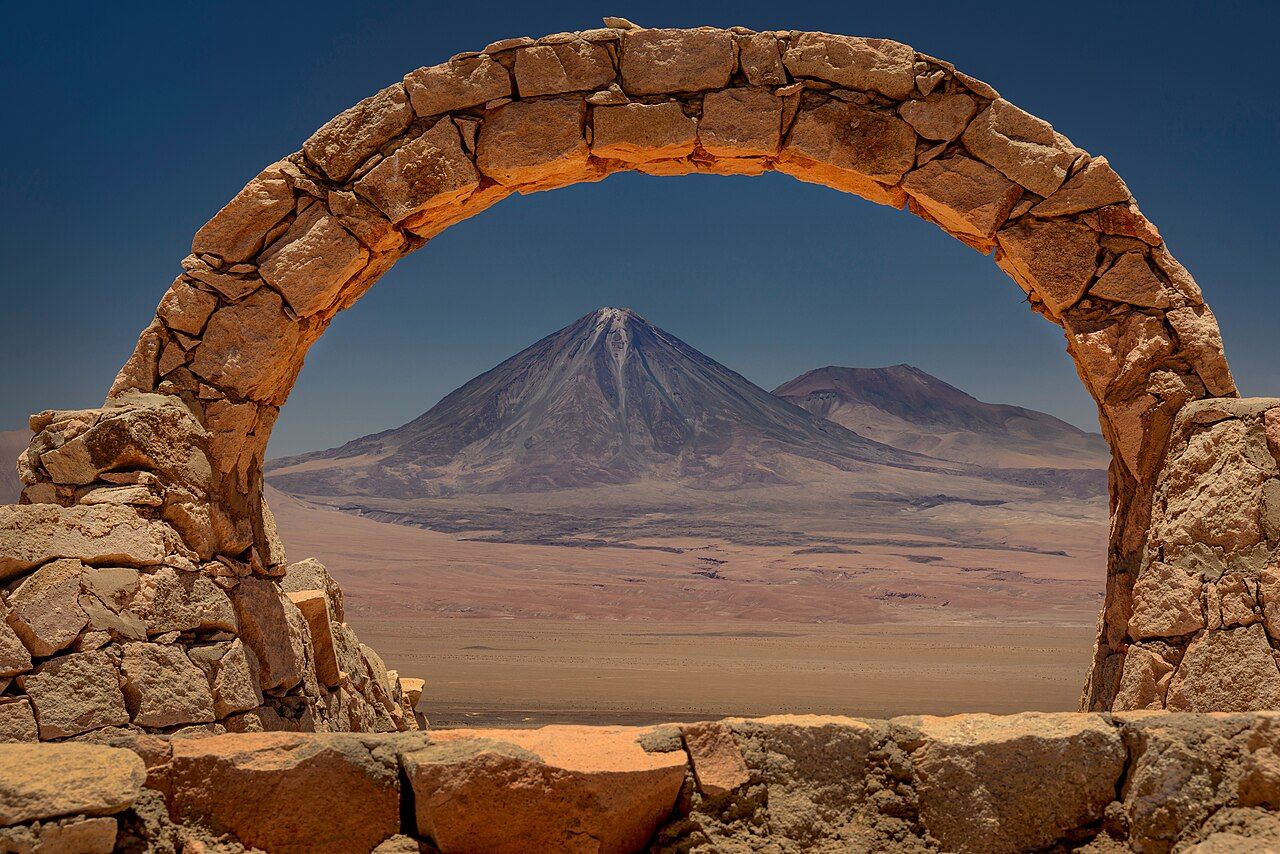
Above the ruins, the path continues to higher viewpoints on the ridge. Along the way you pass carved figures and a stone arch built in modern times. From the arch, the volcano Licancabur sits neatly in the curve of the stones, one of the most photographed views in the region.
The view of the oasis
The reward for the climb is the whole oasis laid out below you. The San Pedro river runs past the foot of the hill, lined with trees and small green fields, and the town sits further south among its adobe walls. Beyond it the land falls away to the white expanse of the salt flat.
To the west rise the jagged ridges of the Cordillera de la Sal, where the dunes of Valle de la Muerte lie hidden behind the first ridge. To the east the line of volcanoes runs along the border, with Licancabur standing tallest. Seen together, they explain the life of the oasis: water from the mountains, a green strip where it flows, and desert all around.
From up here you can also see how the old builders fitted their fortress into the landscape. The walls follow the slope and the colour of the rock so closely that from a distance the pukará almost disappears into the hill.
Late afternoon on the ridge
Early morning and late afternoon are the best times. The light is softer, the walls glow a warm brown, and the climb is cooler. Midday is hot and harsh, and the glare flattens the view. In winter the mornings can be very cold, but the air is usually perfectly clear.
Wind tends to pick up in the afternoon, so hold on to hats and keep cameras secure on the upper ridge. If you are combining the visit with other sites, Quitor fits easily into a morning, leaving the afternoon for the lagoons or Valle de la Luna at sunset.
The walk out from town
The fortress is about three kilometres north of the town centre, along a flat road that follows the river. Many people walk or cycle there, which takes under an hour on foot. The road is dusty and unshaded, so go early or late. Taxis and private vehicles can also reach the entrance.
Combine the walk with a look at the farms and orchards along the river, where water from the mountains is shared through channels just as it was when the fortress was built. It is a short outing, but it gives you a strong sense of how the people of the oasis lived, worked and defended their land. Then walk back as the light fades, and read about the adobe town of San Pedro that grew up below.