
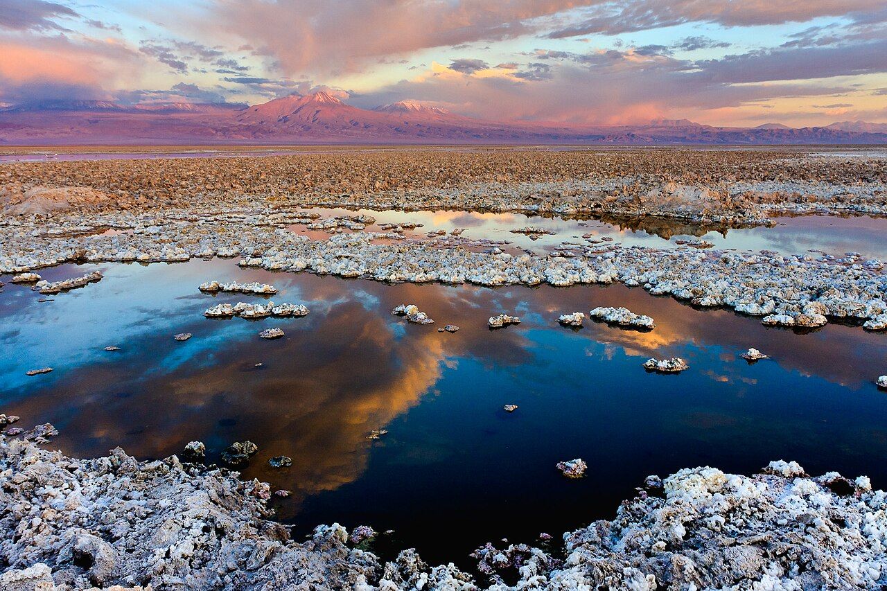
From San Pedro de Atacama, the road south runs along the edge of a vast white and grey plain. This is the Salar de Atacama, the largest salt flat in Chile, covering roughly 3,000 square kilometres. Unlike the smooth white salt flats seen in many photos, its surface is mostly rough, broken crust in shades of white, grey and brown. Here and there, shallow lagoons shine blue and silver, and in them stand the flamingos.
How the salt flat formed
The salar sits in a basin with no outlet to the sea. Water from the Andes flows down into it, mostly underground, carrying dissolved minerals. In the dry air and strong sun, the water evaporates, and the minerals stay behind as salt. Over a very long time, this has built up a thick crust of salt and mud.
Near the edges, groundwater reaches the surface and forms shallow lagoons. These are rich in minerals and in tiny organisms that thrive in salty water, such as brine shrimp and algae. That food is what draws the flamingos.
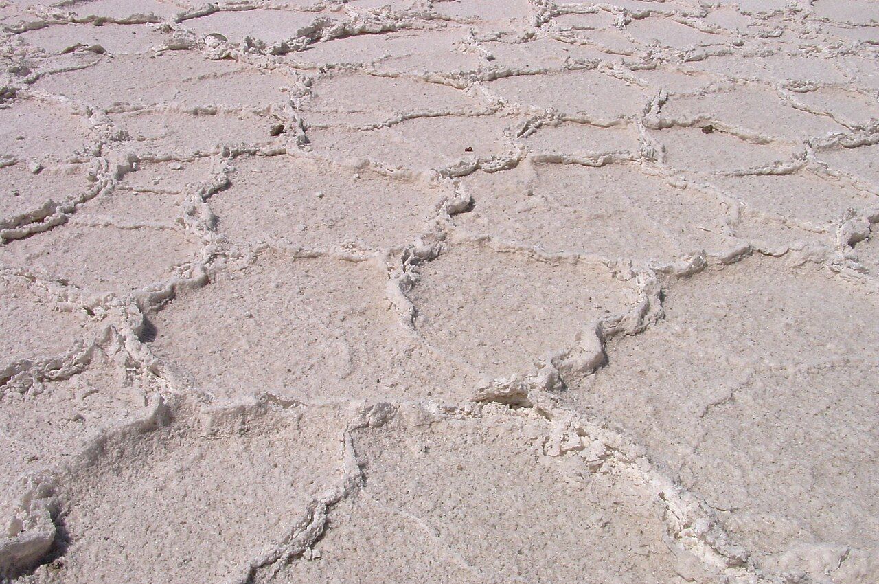
The crust itself is worth a close look. Salt pushes up into jagged lumps and plates as water rises and dries, and the edges can be sharp enough to cut skin. Sit still beside it on a hot afternoon and the plain seems to shimmer, with the volcanoes floating above a band of mirage.
Laguna Chaxa and the reserve
The best-known place to see flamingos on the salar is Laguna Chaxa, part of the Los Flamencos National Reserve. A short path leads from a small visitor area to viewpoints and walkways beside the lagoon. Local Lickanantay communities take part in running the site, and there is an entry fee and set hours.
The reserve protects several separate areas, including lagoons, salt flats and high Andean wetlands. Its name means the flamingos, after the birds that are its symbol. Rules generally ask visitors to stay on paths, keep noise down, and never chase or disturb wildlife.
Look up next: Floating at Laguna Cejar
Chaxa lies about an hour's drive south of San Pedro, past the oasis village of Toconao. The road is mostly paved, with a final stretch on gravel. Many visitors pair it with a trip to Miscanti and Miñiques, the high lagoons, further south and much higher.
Three kinds of flamingo
Three species of flamingo live on the salt flats and lagoons of the Atacama region:
- Andean flamingo: large, pale pink with a dark rear and a bill that is yellow at the base and black at the tip.
- Chilean flamingo: pale pink with greyish legs and pink knees, and a bill that is pale with a black tip.
- James's flamingo: the smallest, with a bright yellow and black bill and dark red legs.
Telling them apart takes some patience and a pair of binoculars. Watch how they feed: flamingos sweep their heads upside down through the water, filtering food through their bills. Their pink colour comes from pigments in what they eat.
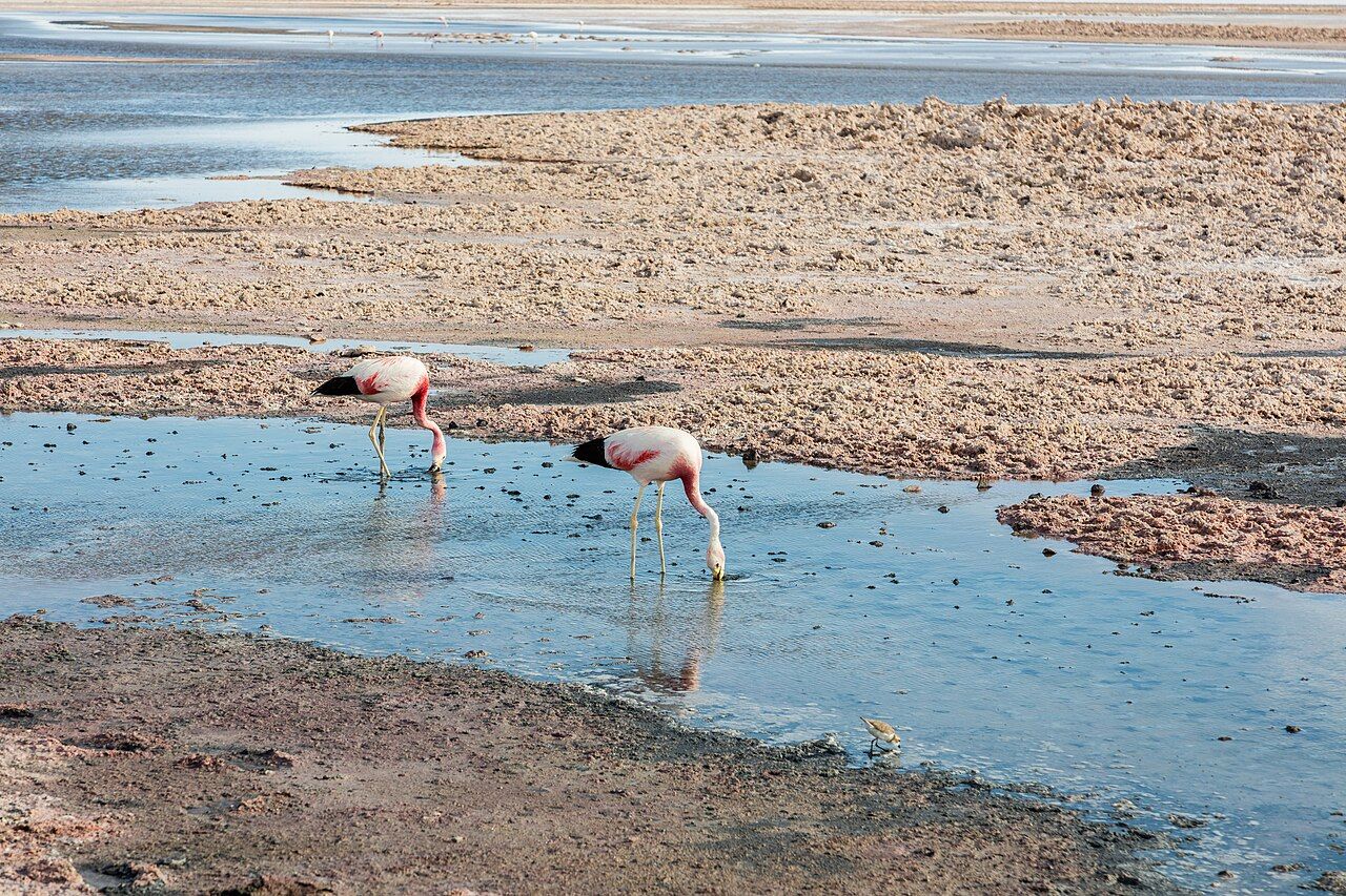
Numbers vary with the season and the year, and the birds move between lagoons and higher wetlands. You may see a few or a large flock. Other birds also visit, including small waders and Andean gulls. A flamingo standing on one leg in cold water is not resting badly; it is saving heat. Watch for a while and you may see a group march together in a short display, heads high, turning in step.
Still water at sunset
Morning and late afternoon are the best times. The light is softer, the colours richer and the wind often calmer than at midday. At sunset, the volcanoes to the east catch the last light and turn pink and orange, reflected in the still water.
The salar is hot by day and cold after sunset, so bring both sun protection and a warm layer. The bright salt reflects sunlight, so good sunglasses matter. At about 2,300 metres, the altitude is close to San Pedro's, so most people feel no extra effect, but the sun is strong. Take water, as there may be little available on site.
Respecting the salar
The salt crust and lagoons are fragile. Footprints and tyre tracks can last for years, and walking near the water can disturb feeding or nesting birds. Stay on marked paths, keep your voice low, and use binoculars or a zoom lens instead of trying to get closer.
The salar is also home to large-scale mining, especially for lithium, mostly in its southern part. How that affects water, wildlife and nearby communities is a subject of debate in the region. As a visitor, you will mostly see the reserve areas, but it is worth knowing that the water feeding these lagoons is precious and contested.
After dark on the salt flat
When the sun goes down, the salar becomes very quiet and very dark. Its flat, open horizon makes it a good place to watch stars rising over the volcanoes. On moonless nights the Milky Way stands out sharply, reflected faintly in any still water. Check moon phases and the best nights to choose a good evening, and see the southern sky for northern eyes for what to look for once the sky is dark. Remember that reserve areas often close at sunset, so stargaze only from places where it is allowed and safe.