
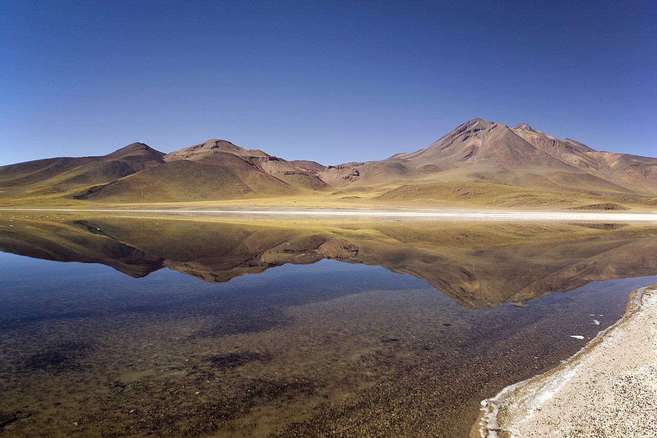
South of San Pedro de Atacama, the road climbs out of the salt basin towards the high plateau of the Andes, the altiplano. Above the village of Socaire, at a little over 4,000 metres, two lagoons sit in a wide basin of yellow grass and dark volcanic rock. Laguna Miscanti is the larger; Laguna Miñiques lies just beside it. The volcanoes of the same names rise above them, and on a calm day their shapes reflect in the deep blue water.
The lagoons and their volcanoes
Miscanti and Miñiques were once part of the same lake. A lava flow from Miñiques volcano is understood to have separated them long ago, leaving two lagoons side by side. Their water is cold and salty, and its blue comes from the depth of the water and the clear, thin air above.
The volcanoes around them are tall, rounded cones, often dusted with snow after storms. Miscanti volcano rises above the larger lagoon, while Miñiques, with its several peaks, dominates the southern skyline.
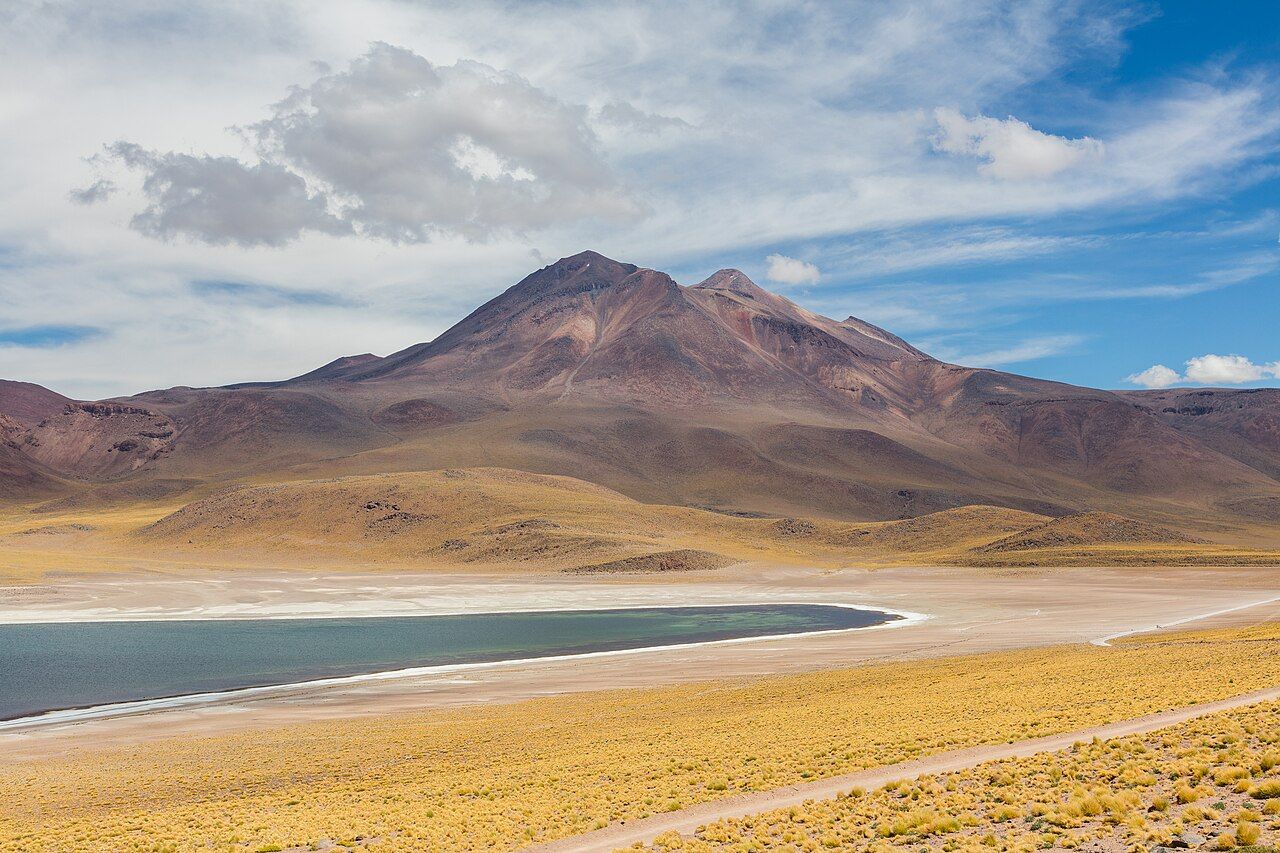
The light here is sharp and the colours strong: blue water, golden grass, dark lava and white salt along the shores. Clouds cast moving shadows across the slopes. On still mornings, the water can be glassy, reflecting the mountains almost perfectly. Wind often picks up later in the day.
Wildlife on the high plain
The grassland around the lagoons supports wildlife adapted to cold, thin air and strong sun. Vicuñas, the slender wild relatives of llamas, graze in small groups on the slopes. They are shy but often visible from the road and the viewpoints. Andean foxes sometimes hunt along the edges. Their thick, pale coats and calm grazing show how well they have adapted to a place where nights freeze for much of the year and the midday sun burns. Watch them from a distance, quietly; a vicuña that lifts its head and stares is already uneasy.
The lagoons are also important for birds. Horned coots, a rare species that builds large nest mounds of stones in the water, breed here. Flamingos visit at times, and ducks and gulls rest on the water. Parts of the shore may be closed during nesting seasons to protect them.
Look up next: Desert heat, desert cold
To protect all this, visitors keep to set paths and viewpoints. Do not walk to the water's edge where it is not allowed, and never approach or feed animals.
Socaire on the way
The road to the lagoons passes through Socaire, a small Lickanantay village at around 3,200 metres. Stone and adobe houses stand among farming terraces built on the slopes, where people grow crops using water from the mountains. A small church sits near the centre. The village is a reminder that this high land has long been farmed and cared for.
The lagoons lie on land managed by the Socaire community, who run the access point and charge an entry fee. Respect village life when you pass through: drive slowly, avoid entering private land, and remember that sacred places and terraces are not open for wandering. The guide to the Lickanantay people and the land offers some background.
Altitude care
At about 4,100 metres, the lagoons are far higher than San Pedro. Many people feel the effects: headaches, breathlessness, dizziness or nausea, sometimes after just a short walk. Severe altitude sickness can be dangerous.
- Spend a few days in San Pedro before going this high.
- Drink plenty of water and avoid alcohol the day before.
- Walk slowly and rest often at the viewpoints.
- If symptoms get worse, go back down.
Anyone with heart or lung problems, high blood pressure, or who is pregnant, should talk to a doctor before planning the trip. The guide to altitude, dry air and your body has more advice.
Two hours south, past Socaire
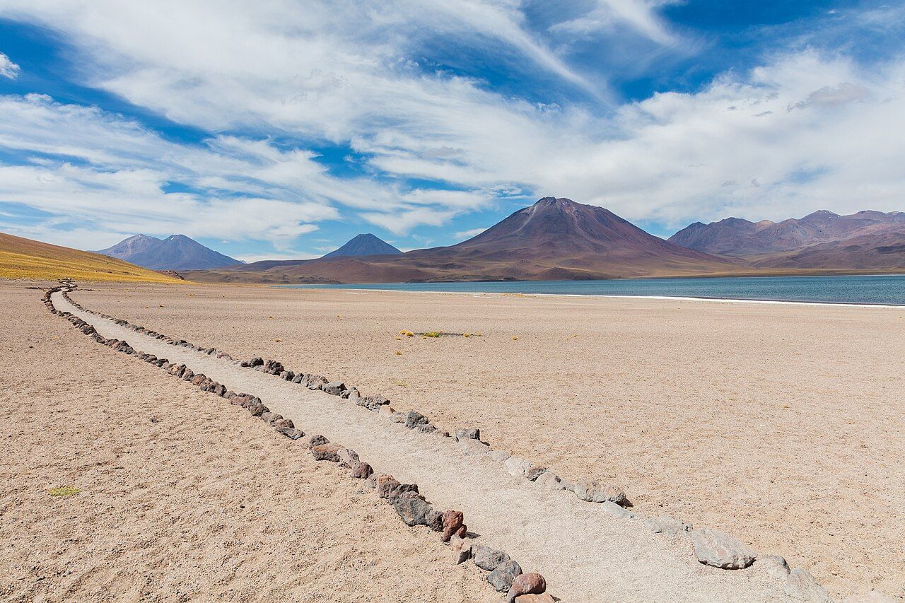
The lagoons lie roughly 115 kilometres south of San Pedro, about two hours by road. The route passes the salt flat, the oasis of Toconao and Socaire before climbing the final stretch. Many people combine the trip with a stop at the Salar de Atacama and Laguna Chaxa on the way back.
Mornings usually bring calmer air and better reflections; the afternoon wind can be strong and cold. Summer storms, from about December to March, can bring snow or close the road for a time. Even on sunny days, the air is cold, so bring a warm jacket, hat and gloves, as well as sun protection.
Fuel and services are scarce once you leave San Pedro, so fill the tank in town and carry food and water for the whole day. Mobile signal can disappear for long stretches. Drive slowly on the gravel, and watch for vicuñas crossing; they often step onto the road without warning, and dusk is the riskiest time.
Respect for a fragile place
The high lagoons are fragile. Plants grow slowly, soils are thin and tracks last for years. Keep to paths, take rubbish away with you, and leave stones, plants and anything else where you found them. Drones may not be allowed.
A visit here can be quiet and powerful: blue water, still air and the sense of standing on the roof of the continent. Take time to sit, breathe slowly and look. The silence and space are as much a part of the place as the views. Flamingos sometimes feed along the far shore.