
North of San Pedro the desert changes character. The salt and sand of the basin fall behind, the road climbs, and the hills start to show colours that seem too bright for bare rock. Red slopes sit beside green ones, white bands run through purple, and in the middle of it all a small river cuts a green line through a valley known as the Valle del Arcoíris, the Rainbow Valley.
On the way you pass one of the finest rock art sites in the region, Hierbas Buenas, where dozens of boulders carry figures carved into their surfaces. Together they make a long but rewarding day, very different from the classic outings nearer town.
Rock that changes colour
The colours of Rainbow Valley come from minerals in the rock. Iron oxides give the deep reds and oranges, other minerals produce greens and grey-blues, and layers of salt and gypsum add streaks of white. Millions of years of folding have tilted the layers so that they run up and down the slopes in stripes rather than lying flat.
The effect is strongest when the sun is not directly overhead. Mid-morning and mid-afternoon bring out the contrasts, while the flat glare of noon washes some of them away. Walking slowly through the valley floor, you see the colours shift with every turn of the path.
The valley lies on land used by the community of Río Grande, a small village of farmers and herders further up the river. The community manages access and charges an entry fee, and arrangements can change, so ask in San Pedro about the current situation before you set out.
Hierbas Buenas, the carved boulders
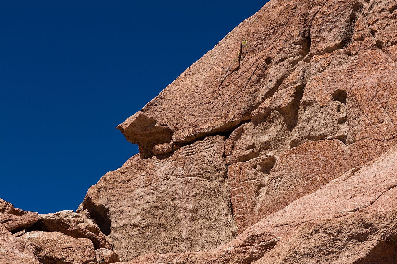
Hierbas Buenas sits on an open slope where a cluster of reddish sandstone boulders rises from the gravel. At first glance they look like ordinary rocks shaped by wind. Then the light catches a line, and you see a llama, then another, then a whole group of animals walking across the stone.
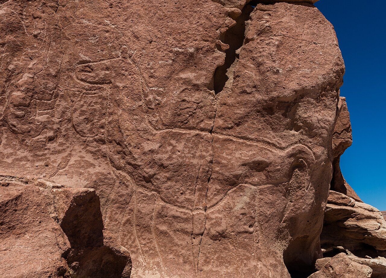
The figures were made by pecking and scraping the dark surface of the rock to reveal the paler stone beneath. Llamas are the most common subject, single or in lines, some with young beside them. Foxes appear too, along with birds that may be rheas or flamingos, and a figure many people read as a monkey, an animal that never lived in this desert.
Most of the carvings are thought to be roughly two thousand years old or more, and they are usually linked with the people who moved goods between the coast, the oases and the high plateau with trains of llamas. Hierbas Buenas lies on one of those old routes, and the carvings may have marked a resting place, a boundary, or a spot with spiritual importance. Nobody can say for certain, and the mystery is part of their power.
Look up next: The Lickanantay people and the land
Respect for the rock art
Rock art is fragile and cannot be repaired. The surface that carries each figure is a thin crust, and every touch, scratch or splash of water speeds its wear. A few simple habits protect it for those who come after you.
- Look, do not touch. Oils from skin darken and weaken the stone, even if you only trace a line with a finger.
- Never climb on the boulders or lean against them for a photograph.
- Do not wet or chalk the carvings to make them show up better. The light does that if you wait.
- Stay on the marked paths, which keep feet away from the bases of the rocks.
- Leave stones where they are, and add nothing to the site.
For the communities of the region, these places are part of a living heritage, not abandoned ruins. Treat them as you would a church or a cemetery, with quiet and care. The same respect applies at the old village of Tulor and the other archaeological sites around the oasis.
Reading the carvings
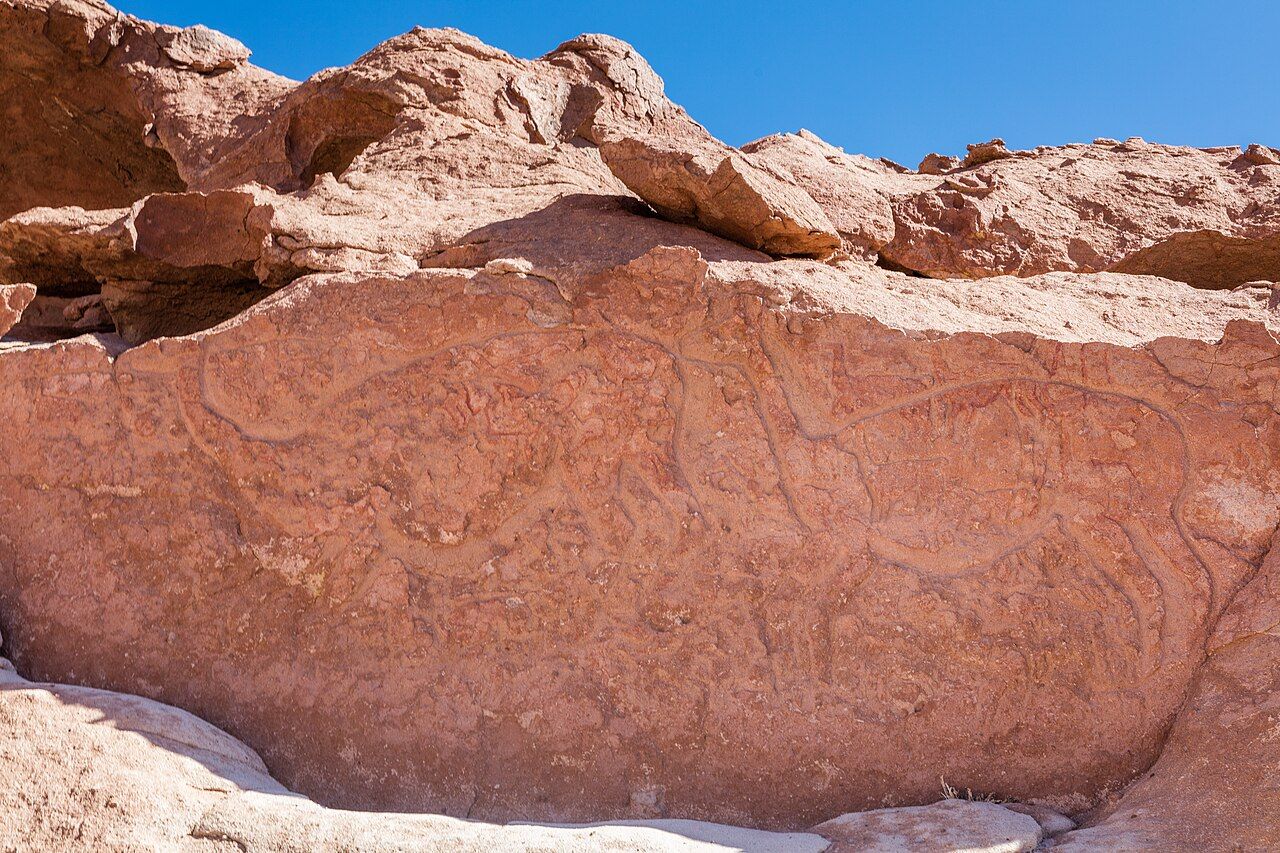
The best way to see the figures is to walk slowly round each boulder and watch how the light falls. Carvings that are invisible from one side jump out from another. Morning and late afternoon, when the sun is low, make the shallow lines cast tiny shadows and are by far the best times.
Notice how the animals are drawn. Llamas often show their long necks and raised tails, foxes their pointed snouts and bushy tails. Some panels pack animals together so tightly they overlap, which suggests that people added to them over long periods. A pair of binoculars helps with the higher surfaces you must not climb.
Two hours towards Calama
Both sites are a long way from town, roughly two hours' drive each way, first on paved road towards Calama and then on gravel north into the hills. If you drive yourself, carry plenty of water and food, fill the tank before you leave, and check the route carefully, as signs are few. A high-clearance vehicle is a help on the rougher sections.
The road gains height along the way, so the air thins a little. Most people manage well if they have already spent a few days in San Pedro, but read up on altitude and your body if you have just arrived. Shade is scarce at both sites, and the sun is intense even when the wind feels cool.
Spring and autumn give the most comfortable temperatures. Summer can bring afternoon storms to the hills, sometimes closing the gravel roads, while winter mornings are cold, though the days are usually clear.
Combining the outing
Many people pair the two sites in a single day, with the rock art in the morning and the valley in the afternoon, or the other way round depending on the light. Some routes also pass small farming villages, where terraces and irrigation channels still bring water to fields in the narrow valleys.
Back in San Pedro, the contrast with the salt-white lowlands is striking. You will look at the ridges of Valle de la Luna differently after a day among coloured hills and carved stones, knowing how many people walked these routes long before any road was built.