
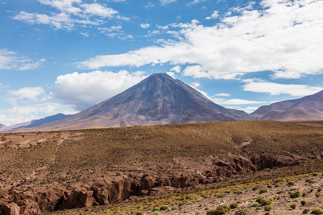
Look east from almost any street in San Pedro and the same shape fills the end of the view: a tall, symmetrical cone, dark brown in the morning, rust and violet in the late afternoon, sometimes dusted white after a winter storm. That is Licancabur, and it sits on the border between Chile and Bolivia like a marker post set down by a giant.
The volcano is close to six thousand metres high, and it rises so cleanly from the plateau that it seems nearer than it is. In reality its summit is a long way off and far above anything you will reach on a normal trip. For most visitors, Licancabur is something to watch rather than climb, and watching it is a large part of the pleasure of staying in the oasis.
A cone on the border
Licancabur is a stratovolcano, built up over a long period from layers of lava and ash. It is considered dormant, with no eruptions in recorded history, though its shape is young and sharp compared with the worn, rounded peaks around it. Its neighbour to the east, Juriques, is lower and broader, with a wide summit crater, and the two together form the familiar pair on the skyline.
The international border runs across the mountain. The western flanks fall towards Chile and the Salar de Atacama, while the eastern side drops to the high plateau of southwestern Bolivia, where two lakes, Laguna Blanca and Laguna Verde, lie at its foot.
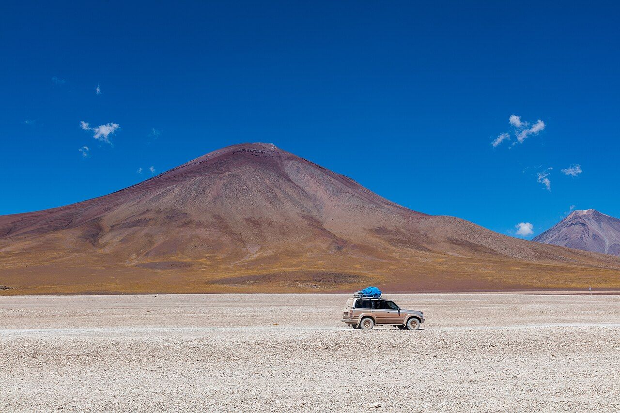
From that Bolivian side the volcano looks quite different: closer, broader, more brown and grey, with the white plain stretching to its base. Many travellers see both faces, first from San Pedro and then on a crossing into Bolivia.
What the name and the mountain mean
The name comes from Kunza, the old language of the Lickanantay, and it is often translated as "mountain of the people". The translation fits. For the communities of the oasis the volcano is more than scenery. It is a powerful presence, linked with water, weather and the ancestors, and it is greeted and respected in ceremonies that continue today.
People climbed it long ago. Archaeologists have found stone structures near the summit that are usually linked to the Inca period, when high peaks across the Andes became places of offering. It is worth holding that in mind when you hear about climbing it: the summit is a sacred place as well as a high one.
Learn more about this side of the region in the story of the Lickanantay people and the land, which explains how mountains, water and the earth fit together in local belief.
The crater lake
At the top, inside the summit crater, lies a small lake. It is one of the highest bodies of water in the world, and for much of the year it is covered by ice. The water stays strange and cold, yet tiny organisms live in it, and scientists have studied the lake as an example of how life copes with thin air, intense ultraviolet light and freezing temperatures.
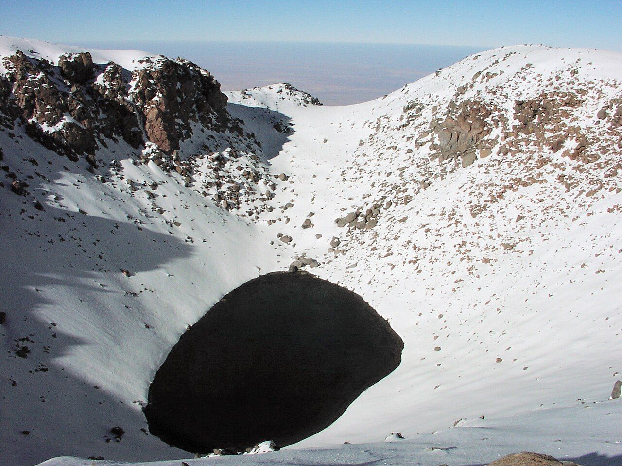
Seeing it means climbing to the summit, which takes you well into the zone where the body struggles with lack of oxygen. That is a serious undertaking, not a day out from town.
Look up next: Altitude, dry air and your body
Why most people just look
Climbs of Licancabur generally start on the Bolivian side, near the lakes at its foot, because the approach there is shorter and the route is better established. That means a border crossing, permits, and an entry into a protected area, each with its own rules and charges.
The climb itself is long and steep, on loose rock and scree, often in strong wind and severe cold, and it reaches an altitude where even fit people suffer badly. Anyone thinking about it needs to spend days acclimatising at lower heights first, needs experienced mountain guidance, and should talk to a doctor before travelling. Altitude sickness at that height can become life-threatening quickly.
For everyone else, the volcano works best at a distance, and there are plenty of good places to watch it from.
- From the stone arch at the Pukará de Quitor lookout it sits framed in the curve of the arch.
- From the salt lagoons to the south it rises behind the water, often reflected on calm days.
- From the dunes and ridges west of town it glows at sunset, long after the valleys have gone into shadow.
- From the road out towards the border it grows larger with every kilometre, until it fills the windscreen.
Licancabur at night
After dark the volcano takes on a new role. Its outline is black against the starfield, and on a clear, moonless night you can watch the stars wheel slowly past its summit. In the hours after sunset the band of the Milky Way stands over the eastern horizon in some seasons, and the cone makes a natural foreground for a long exposure.
A bright moon changes everything. Rising behind the mountain, it first lights the snow and rock along the ridge, then appears suddenly over the summit, so bright that the stars around it fade. If you are hoping for a dark sky, check the calendar for a new moon. If you want to see the volcano itself after dark, a full moon is the time.
A tripod, a wide lens and a little patience are enough for a first attempt. Pointing the camera east from a dark spot outside town gives you the cone and the sky together, and the advice on photographing the stars covers the settings. Wear warm clothes: on clear nights the air near the volcano's foot loses its heat fast, and you will be standing still for a long time.
Seeing it well
The light changes constantly. Early morning gives a hard, clear outline with the sun behind it, while late afternoon softens the slopes and brings out the colours of the rock. Haze is rare, but dust raised by wind can blur the view on some afternoons. After snow in the winter months, the cone looks its most dramatic, white at the top and dark below.
Binoculars repay a look. With them you can follow the lines of old lava down the flanks and see the scar of the summit crater. Then lower them, and see the whole mountain again as the people of the oasis have seen it for thousands of years: a constant, quiet presence on the edge of the sky.